August 2, 2020.
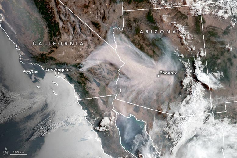
On August 2, 2020, the Geostationary Operational Environmental Satellite 17 (GOES-17) acquired this image of the Apple Fire as it raged near San Bernardino National Forest.
GOES-17 is operated by the National Oceanic and Atmospheric Administration (NOAA); NASA helps develop and launch the GOES series of satellites.
The fire started on July 31, and by the morning of August 2, the long smoke plume had Arizona residents waking up to an orange-tinted sky.
As of the morning of August 3, the fire had consumed more than 40 square miles (100 square kilometers) and was 5 percent contained.
NASA Earth Observatory image by Joshua Stevens, using GOES 17 imagery courtesy of NOAA and the National Environmental Satellite, Data, and Information Service (NESDIS).
August 2, 2020
August 2, 2020
Copyright © 1998 - 2020 SciTechDaily


 UK
UK Australia
 France
 Germany
 Russia
 India
India Canada